
⚡ With almost €1 million in prizes, this edition of the #myEUspace competition was one of the biggest competitions ever organised by EUSPA.
The #myEUspace competition is where the emotions are really running high.
#myEUspace competition is a EUSPA initiative supporting the development of innovative commercial applications that leverage data coming from the EU Space Programme.
This year, 54 teams embarked on a mission to bring disruptive space-based commercial solutions and applications to the European market. From Smart mobility to quantum technologies, these startups are bringing innovation to a wide range of sectors.
The battle for a share of a €1 million prize pool has concluded during the Entrepreneurship Day at EUSPA, and the finalists impressed the jury with their solutions involving space data, Galileo and Copernicus technologies.
https://www.youtube.com/watch?v=i16z-fdGPz4
There are exciting opportunities in space, and these startups have sights set on success
The myEUspace competition uncovered the gems in six categories and put them in the spotlight. The projects were submitted in two tracks.
In Track 1, the innovators had to develop their theoretical idea into a prototype while in Track 2, the innovators had to turn their existing prototype into a product and launch it on the market.
Are you ready to meet the hottest startups and their disruptive technologies presented during myEUspace Innovation Competition? 🏆
🚄 Category 1: Smart Mobility Solutions
🏆 Track 1: SaNGENE Project

SaNGENE stands for Sens And Nav on GNSS Environment Estimation. The project was submitted by M3 Systems and Tilt Consulting and it integrated GNSS-based passive radar for detection and first localisation of obstacles.
The finalists:
- NEUROSPACE: revolutionises cargo and assets tracking deploying AI and machine learning to analyse satellite imagery and provide precise location in real-time.
- GEL System: an on-the-fly solution for finding emergency landing zones for aircraft.
- IcePass: the solution is using the Sentinel-1 and Sentinel-2 satellite mission data for gathering data useful to describe surroundings.
🏆 Track 2: C-ITS Platform
C-ITS Platform is a central vehicle-to-everything (V2X) management system for road operators and traffic managers running Cooperative Intelligent Transport Systems (C-ITS).
The finalists:
- Tunnll: a sustainable urban bus service for struggling small towns. It is convenient, easy to use and gives its user the freedom of mobility.
- NavcomX: a solution for precise location currently developed for trains.
📱 Category 2: Consumer Solutions for health, gaming, sports, leisure, tourism and everyday life
🏆 Track 1: EO4ART
EO4ART is a web application for artistic and personalized products based on satellite images.
The finalists:
- YourLox: smart-lockers placed in public areas to rent equipment for the sport.
- Ecotope: AI-powered virtual biome creation kit.
- FREJATECH: A security solution for women’s safety.
- Cardia – Find your rhythm: App that automatically measures stress to prevent cardiovascular diseases with Galileo.
🏆 Track 2: E20.Green
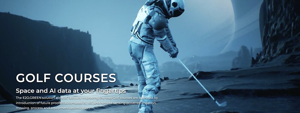
E20.Green is an Intelligent Platform powered by GNSS, AI, EO and IoT to enable Golf Course and Urban Green Space Management companies to effectively manage assets, operations and land fields.
The finalists:
- Cardia – Find your rhythm: App that automatically measures stress to prevent cardiovascular diseases with Galileo.
- BIEL SMARTGAZE: Smart Glasses that solve the mobility issues and increase the autonomy of visually impaired people, using a combination of mixed reality (XR) with AI, robotics and Galileo geo-positioning.
- Aurora Catcher: enabling the experience of the northern lights by quantum magnetometry and Copernicus data.
🌲 Category 3: Solutions addressing Environmental Challenges
🏆 Track 1: ALTIWAVE
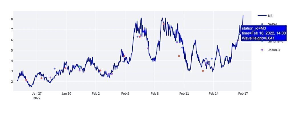
Satellite-derived regional wave heights for the marine energy sector. Freely available Earth Observation resources can provide quality satellite-derived data for many metrics, including wave height. Unlike wave-buoys, satellites have excellent spatial coverage but poor temporal coverage at a single location due to their orbit.
The finalists:
- SustCoast: Digital platform for quantitative AI-satellite-based monitoring of the transparent and shallow coastal waters.
- WatQEO: monitoring of lake’s water quality through Earth observations. Sentinel-2 data and machine learning algorithms will be used to detect algal blooms and other quality parameters, to be provided to Water Utilities and Public Agencies.
- PEATZ: empowers peatland restoration actions by monetising carbon reduction.
🏆 Track 2: SPAI
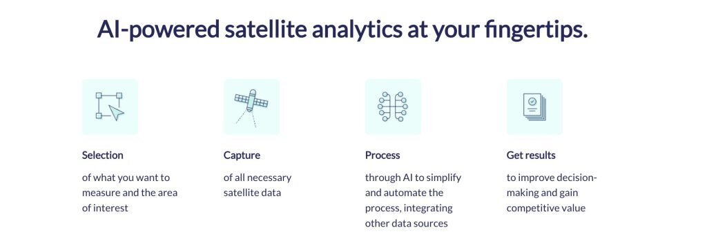
Solution to easily integrate satellite analytics in the work practices of experts and nonexpert users, extracting the EO value through AI effortless.
The finalists:
- Village Data Analytics: SaaS platform to help our users plan and monitor their projects across the world using satellite imagery and on-ground sensor data.
- Soil Organic Carbon Monitor (S.O.C. Monitor): a cost-effective, time-saving SaaS for the Spatio-temporal monitoring of Soil Organic Carbon using Earth Observation-powered analytics serving Natural Climate Solutions (NCS).
- Water me!: with a help of EO data Water me! engages people to adopt and care about trees in cities. Water me! app educates and coordinates to make cities green and full of active people.
🗺️ Category 4: Surveying Solutions to shape the future of geomatics
🏆 Track 1: Master Map
Master Map is a digitized service capable of providing maps of the defects of the roads for maintenance optimization. The user can import the road status and defect maps into their Geographical Information System (GIS).
The finalists:
- Dron.City: is an Uber for drone data. Application for quick ordering of photos and videos from nearby drone operators to generate high-resolution maps and 3D models.
- SurplusMap: is facilitating the green transition with Satellite imagery and AI.
- UGRAM: is utilizing Galileo’s high accuracy service (HAS) to continuously detect and map Road Asset Management (RAM) inventory in real-time using a multi-purpose in-car computer vision system.
🏆 Track 2: SOILSPECT
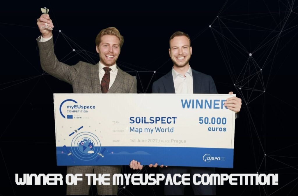
By combining the latest GNSS hardware and the Internet of Things, SOILSPECT automatically monitors ground settlement at construction sites.
The finalists:
- Wildsense: monitors and improves forest health using satellite imagery.
- Arte Mapp: is an affordable and practical terrain mapping solution that enables fast and frequent surveying of a selected area by merely walking along an AR-assisted path.
- OWL Marketplace: democratizing the access to Satellite Earth Observation Technology through the e-commerce platform.
🌱 Category 5: Solutions that manage the variability of Agricultural Production
Track 1 finalists:
- Farming AI Resource Manager: supports the farmer’s decision-making throughout the year in his agricultural work. The system determines the best times to apply the products and the suggested doses so that the farmer knows when to apply the products and in what quantities.
- VirtuaCrop: an app for sustainable precision farming that turns phones into data gathering and analysis tools.
🏆 Track 2: Agricircle
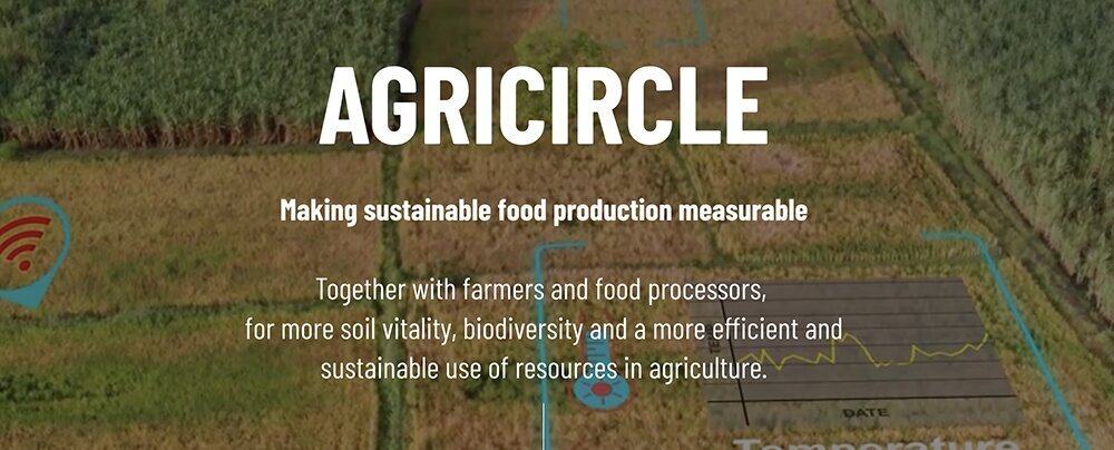
AgriCircle is a leading provider of technologies for more productive and sustainable agriculture. We offer networks and incentives for climate-neutral farming on a regenerative base.
The finalists:
- LAYERS: system combining AI, satellite and drone data to offer unique information to the agricultural sector.
- CAFA Worker robot: a mobile robot that works both autonomously and over 4G/5G teleoperation mode and replaces the human presence in Dirty-Dull-Dangerous jobs.
- LHTPU (LeanConnected Herd Tracking & Pasture Usage): connected GPS collars tracking herd position, activity, health & pasture zone usage for remote territories.
- SAT DEX-YIELD: satellite imagery analytics-based crop yield index insurance for smallholder farmers.
⚛ Category 6: Innovative Solutions applying quantum technologies
🏆 Track 1: RIGOROUS
RIGOROUS aims for the efficient and effective development and deployment of solutions based on using Randomness-Intensive alGOrithms for near-real-time ROUte optimiSation.
The finalists:
- IRQAN: the project aims at creating a quantum-ready digital model to map and track satellites and debris to simulate potential trajectories and scenarios, and finally determine optimal moves to avoid object collision.
- QBM4EO: a supervised quantum machine learning system for Earth land cover understanding.
Do you have an idea or a space-based technology and looking to fund your startup? Make sure to follow EUSPA and AlphaGamma to stay updated on the next editions of Entrepreneurship Day!
For more life-changing opportunities, subscribe to our weekly newsletter and follow us on Twitter, Facebook, Instagram and LinkedIn.


